Island-on-Map.com The Free Beach Guide HomeCountriesMenu

Malta Island

Ultimate guide (April 2024)
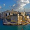
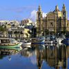
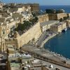
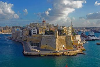
Malta Island is located in the Mediterranean Sea located to the south of Italy. Valletta is a beautiful town with unique architecture. The island has some of the best beaches in country. Unfortunately, Malta beaches are rather mediocre even by European standards. Shore and seabed: rocks, sand. [edit]
This island ranks #21 of the "Best islands in Europe"
Rating: 7.6 - 3919 votes [vote]
Coordinates: 35.895975, 14.436934
See also: Best beaches in Malta Island

Hotels [edit]

There is a large number of hotels on the island, including cheap options. Most hotels are located in Valletta.

How to get there [edit]

Fly to Malta International Airport (MLA). Next follow by a taxi or by bus.

When to go [edit]

Summer half of the year, if the main purpose of your trip is a beach vacation.

Rainfall, mm
Rainfall, mm

Water temperature, C

Temperature, C
Temperature, C

Humidity, %
Humidity, %

Wind speed, meter/sec

Open map

See also other islands nearby:

 
Malta, Comino island, clear water 6.6
16 km to the north-west
Location: Europe, Malta
Rating: 6.6 (711 votes)
Malta, Gozo island, Azure Window rock 6.8
23 km to the north-west
Location: Europe, Malta
Rating: 6.8 (432 votes)
Italy, Lampedusa island, Rabbit Beach 7.8
170 km to the west
Location: Europe, Italy
Rating: 7.8 (1755 votes)
Italy, Sicily island, San Vito Lo Capo beach 8.2
180 km to the north
Location: Europe, Italy
Rating: 8.2 (1175 votes)
Italy, Pantelleria island, Specchio di Venere lake 7.0
240 km to the west
Location: Europe, Italy
Rating: 7.0 (410 votes)
💖
If you liked this page, please share it on: Facebook, Twitter, Instagram
…or any other web-site
 
This will help the project greatly!

 
To the top of this page »
 
© 2024, Island-on-Map.com · Menu