
Aneityum island
Ultimate guide (June 2026)
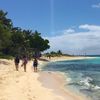
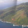
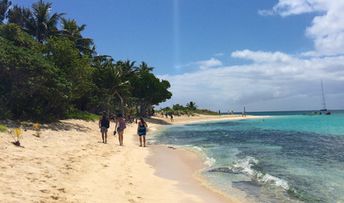
Aneityum is the southernmost of the large islands in Vanuatu. There are no beaches, but superb Mystery Island is located just nearby. As for the big island, the main attractions are mountain hiking, waterfalls, hot springs and excellent snorkeling. Shore and seabed: stones, sand. [edit]
Coordinates: -20.192937, 169.818238
See also: Best beaches in Aneityum island
Hotels [edit]
There are several local guesthouses on Aneityum island, but these are poorly presented in the international reservation systems.
How to get there [edit]
Fly to Port Vila international airport (VLI), and then fly to Aneityum airport (AUY) located in the Mystery Island. Next take a boat to the main island.
When to go [edit]
The best time to relax on the beaches of Aneityum island is a dry period from July to October.Rainfall, mm

Water temperature, C
Temperature, C
Humidity, %
Wind speed, meter/sec
See also other islands nearby:
170 km to the north-west ↖
290 km to the west ←