Island-on-Map.com The Free Beach Guide HomeCountriesMenu

Tahanea atoll

Ultimate guide (August 2025)
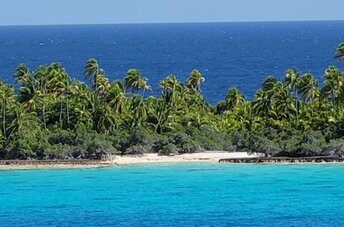
Tahanea is an uninhabited atoll located to the east of Rangiroa Atoll in French Polynesia. There are no beaches. And even sandy sea bottom is rare. Small fisherman's house is the only local attraction. So there is nothing to do here. Shore and seabed: stones, sand. [edit]
This island ranks #28 of the "Best islands in French Polynesia"
Rating: 7.6 - 5 votes [vote]
Coordinates: -16.873731, -144.766955

Hotels [edit]

There are no hotels in Tahanea Atoll.

How to get there [edit]

Fly to Tahiti international airport (PPT), next fly to Faaite airport (FAC) and get by speedboat.

When to go [edit]

The best time for a beach holiday in Tahanea atoll is a dry season from March to October.

Rainfall, mm
Rainfall, mm

Water temperature, C

Temperature, C
Temperature, C

Humidity, %
Humidity, %

Wind speed, meter/sec

Open map

See also other islands nearby:

 
French Polynesia, Faaite atoll 7.8
52 km to the west
Location: Oceania, French Polynesia
Rating: 7.8 (6 votes)
French Polynesia, Raraka atoll 7.9
78 km to the north
Location: Oceania, French Polynesia
Rating: 7.9 (10 votes)
French Polynesia, Anaa atoll, village, aerial view 8.2
98 km to the south-west
Location: Oceania, French Polynesia
Rating: 8.2 (10 votes)
French Polynesia, Fakarava Atoll 8.6
110 km to the north-west
Location: Oceania, French Polynesia
Rating: 8.6 (86 votes)
French Polynesia, Kauehi atoll 8.1
120 km to the north
Location: Oceania, French Polynesia
Rating: 8.1 (11 votes)
💖
If you liked this page, please share it on: Facebook, Twitter, Instagram
…or any other web-site
 
This will help the project greatly!

 
To the top of this page »
 
© 2025, Island-on-Map.com · Menu