Island-on-Map.com The Free Beach Guide HomeCountriesMenu

Madeira islands

Ultimate guide (April 2024)
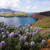
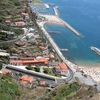
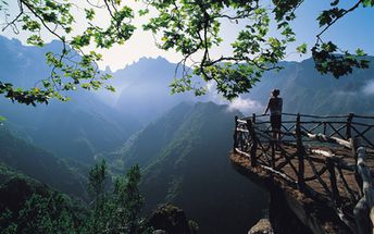
Madeira - an archipelago of islands to the south-west of mainland Portugal. Good beaches are located in the island of Porto Santo. Madeira island will be more interesting to those who like beautiful nature. Shore and seabed: sand, stones. [edit]
This island ranks #19 of the "Best islands in Europe"
Rating: 7.7 - 670 votes [vote]
Coordinates: 32.743089, -16.761465
See also: Best beaches in Madeira islands

Hotels [edit]

Madeira is a premium holiday destinations, so luxury hotels are dominating here. Nevertheless, you can easily find many budget accommodation options.

How to get there [edit]

Fly to Madeira Island international airport (FNC) or fly to Porto Santo Island international airport (PXO).

When to go [edit]

Best time to visit Madeira is the summer half of the year from May to November.

Rainfall, mm
Rainfall, mm

Water temperature, C

Temperature, C
Temperature, C

Humidity, %
Humidity, %

Wind speed, meter/sec

Open map

See also other islands nearby:

 
Spain, Canary Islands, Tenerife island, Las Teresitas beach 8.1
490 km to the south
Location: Europe, Spain, Canary Islands
Rating: 8.1 (269 votes)
Spain, Canary Islands, Gran Canaria island, Maspalomas dunas 8.1
540 km to the south
Location: Europe, Spain, Canary Islands
Rating: 8.1 (184 votes)
Spain, Canary Islands, Fuerteventura island, Sotavento windsurfing 7.7
550 km to the south-east
Location: Europe, Spain, Canary Islands
Rating: 7.7 (426 votes)
Azores, Sao Miguel island, Vila Franca beach 6.0
970 km to the north-west
Location: Europe, Portugal, Azores
Rating: 6.0 (517 votes)
Azores, Terceira island, Biscoitos beach 5.8
1150 km to the north-west
Location: Europe, Portugal, Azores
Rating: 5.8 (1627 votes)
💖
If you liked this page, please share it on: Facebook, Twitter, Instagram
…or any other web-site
 
This will help the project greatly!

 
To the top of this page »
 
© 2024, Island-on-Map.com · Menu