Island-on-Map.com The Free Beach Guide HomeCountriesMenu

St. Thomas island

Ultimate guide (April 2024)
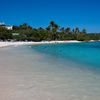
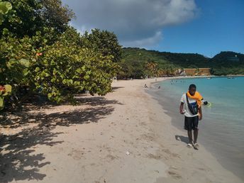
St. Thomas - the most popular island in the U.S. Virgin Islands. There are good beaches, a major international airport and many hotels. Beach: sand. Seabed: sand, stones. [edit]
Rating: 8.2 - 708 votes [vote]
Coordinates: 18.342468, -64.932686
See also: Best beaches in St. Thomas island

Hotels [edit]

There is a great choice of hotels on the island. However, prices are rather expensive, even in the low season.

How to get there [edit]

Fly to St. Thomas Airport (STT). (It often will be cheaper to fly via San Juan Airport (SJU).) Next - by shuttle bus.

When to go [edit]

Any time of year. High season is the winter half of the year. This time there are a lot of people here. Low season is bad only due to hurricanes that sometimes happens in the Caribbean (not every year). It's relatively rainy in the autumn.

Rainfall, mm
Rainfall, mm

Water temperature, C

Temperature, C
Temperature, C

Humidity, %
Humidity, %

Wind speed, meter/sec

Open map

See also other islands nearby:

 
USVI, St. John island, Maho Bay beach, palms 8.7
21 km to the east
Location: Caribbean, USVI
Rating: 8.7 (692 votes)
British Virgin Islands (BVI), Jost Van Dyke island, White Bay 8.9
23 km to the north-east
Location: Caribbean, BVI
Rating: 8.9 (734 votes)
BVI, Tortola island, Cane Garden Bay beach 8.6
33 km to the east
Location: Caribbean, BVI
Rating: 8.6 (214 votes)
Puerto Rico, Culebra island, Playa Carlos Rosario beach 8.3
38 km to the west
Location: Caribbean, Puerto Rico
Rating: 8.3 (998 votes)
BVI, Beef Island, Tortola airport, aerial view 8.3
44 km to the east
Location: Caribbean, BVI
Rating: 8.3 (634 votes)
💖
If you liked this page, please share it on: Facebook, Twitter, Instagram
…or any other web-site
 
This will help the project greatly!

 
To the top of this page »
 
© 2024, Island-on-Map.com · Menu